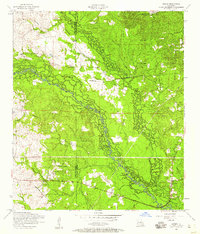
1954 Map of Sieper
USGS Topo · Published 1959About this map
Clifton Crossing and the small settlement of Sieper anchor this mid-century portrait of the piney woods near the boundary of Vernon Parish and Rapides Parish. The landscape is defined by the winding course of the Calcasieu River and its numerous tributaries, including Comrade Creek and Cypress Bayou. A significant piece of industrial history is visible in the form of a dismantled railroad that snakes through the center of the sheet, tracing a path once used for the region's timber commerce. Local life is centered around rural landmarks such as Pisgah Church, Twin-Oak Church, and Big Hammock Church. Genealogists will find value in the specific locations of family-named sites like Marshall Cemetery, Burns Cemetery, and Smith Cemetery, which remain as quiet indicators of the area's early twentieth-century residents.
Find a feature on this map
33 named features on this map. Tap any name to fly to it.
Don’t see what you’re looking for? This feature index may not catch every label — zoom into the map to look around manually.
Map Details
Editions of this 1954 Sieper Map
This is the sole edition of this map. No revisions or reprints were ever made.
Other maps of this area

1932 · Boyce SW
USGS Topo · 1:31,680

1937 · Chopin SW
USGS Topo · 1:31,680

1937 · Chopin SE
USGS Topo · 1:31,680

1941 · Boyce
USGS Topo · 1:62,500

1943 · Leander
USGS Topo · 1:62,500

1944 · Chopin
USGS Topo · 1:62,500

1948 · Chopin
USGS Topo · 1:62,500

1953 · Alexandria
USGS Topo · 1:250,000
1954 · Leander
USGS Topo · 1:62,500
1954 · Temple
USGS Topo · 1:24,000