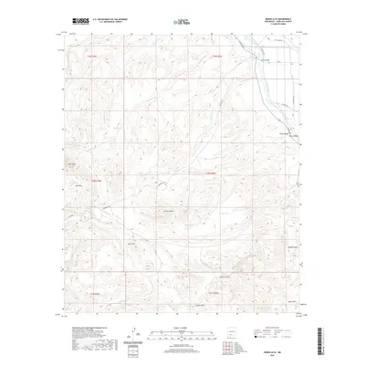
2020 Map of Sierra Alta
USGS Topo · Published 2020About this map
Rio Grande waters flow through the northeastern corner of this landscape, managed by the Rio Grande River Levee and a network of irrigation channels including Tonuco Drain and Rincon Drain. The Tonuco Bridge provides a vital crossing point into the fertile Rincon Valley, while the surrounding high desert is defined by a complex system of arroyos and canyons. Water management in this arid environment is evident through numerous named stock tanks such as Hersey Tank, Hackler Tank, and Basin Tank. Significant topographic landmarks like Sierra Alta and Burro Hill rise above the drainage basins of Reed Arroyo and Broad Canyon, illustrating the varied terrain of Doña Ana County. Ranching infrastructure is further noted by Barksdale Rd and several isolated springs like Silo Spring.
Find a feature on this map
40 named features on this map. Tap any name to fly to it.
Don’t see what you’re looking for? This feature index may not catch every label — zoom into the map to look around manually.
Map Details
Editions of this 2020 Sierra Alta Map
This is the sole edition of this map. No revisions or reprints were ever made.
Other maps of this area

1891 · Las Cruces
USGS Topo · 1:125,000

1893 · Las Cruces
USGS Topo · 1:125,000

1916 · Tonuco
USGS Topo · 1:125,000

1932 · Tonuco
USGS Topo · 1:125,000

1941 · Las Cruces
USGS Topo · 1:62,500

1943 · Corralitos Ranch
USGS Topo · 1:62,500

1943 · Las Cruces
USGS Topo · 1:62,500

1948 · San Diego Mountain
USGS Topo · 1:62,500

1955 · Las Cruces
USGS Topo · 1:250,000

1958 · Las Cruces
USGS Topo · 1:250,000