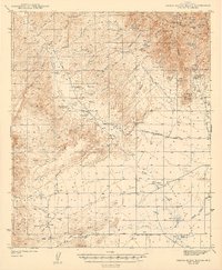
1943 Map of Sierra Bonita Ranch
USGS Topo · Published 1943About this map
Sulphur Spring Valley dominates this high-desert landscape in the early 1940s, a region characterized by remote cattle operations and the early development of rural infrastructure. The Eureka Ranch and the historic Sierra Bonita Ranch anchor the local economy, supported by a network of specialized water sources such as the Birdcage Windmill and Hooker Cienega. The map captures a moment when travel relied on routes like the Bonita Aravaipa Road and the Old Serpentine Road, the latter already falling into disuse.
Find a feature on this map
54 named features on this map. Tap any name to fly to it.
Don’t see what you’re looking for? This feature index may not catch every label — zoom into the map to look around manually.
Map Details
Editions of this 1943 Sierra Bonita Ranch Map
2 editions found
Other maps of this area

1922 · Willcox
USGS Topo · 1:125,000

1938 · Galiuro Mts
USGS Topo · 1:48,000

1938 · Klondyke
USGS Topo · 1:48,000

1940 · Sierra Bonita Ranch
USGS Topo · 1:62,500

1942 · Sierra Bonita Ranch
USGS Topo · 1:62,500

1942 · Mt. Graham
USGS Topo · 1:62,500

1943 · Willcox
USGS Topo · 1:62,500

1943 · Galiuro Mts
USGS Topo · 1:62,500

1943 · Klondyke
USGS Topo · 1:62,500

1943 · Sierra Bonita Ranch
USGS Topo · 1:62,500