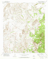
1972 Map of Sierra De La Cruz
USGS Topo · Published 1975About this map
Sevilleta dominates the central landscape of this Socorro County survey, revealing a network of remote ranching outposts and water sources. Named landmarks like Sierra de la Cruz and Black Mesa provide topographic structure to a terrain defined by deep drainage systems including Cibola Canyon and Palo Duro Canyon. The map records a distinct human footprint through numerous isolated wells and tanks, reflecting the vital infrastructure required for livestock in this arid environment.
Find a feature on this map
30 named features on this map. Tap any name to fly to it.
Don’t see what you’re looking for? This feature index may not catch every label — zoom into the map to look around manually.
Map Details
Editions of this 1972 Sierra De La Cruz Map
This is the sole edition of this map. No revisions or reprints were ever made.
Other maps of this area

1906 · Socorro
USGS Topo · 1:62,500

1916 · La Joya
USGS Topo · 1:125,000

1952 · La Joya
USGS Topo · 1:24,000

1952 · Becker SW
USGS Topo · 1:24,000

1952 · Cerro Montoso
USGS Topo · 1:24,000

1954 · Socorro
USGS Topo · 1:250,000

1958 · Socorro
USGS Topo · 1:250,000

1959 · Loma De Las Canas
USGS Topo · 1:24,000

1959 · Mesa Del Yeso
USGS Topo · 1:24,000

1959 · Socorro
USGS Topo · 1:62,500