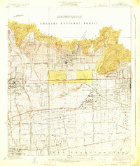
1928 Map of Sierra Madre
USGS Topo · Published 1928About this map
Sierra Madre and Monrovia anchor the northern foothills in this late 1920s survey, where the developing citrus belts and residential tracts meet the steep slopes of the Angeles National Forest. The landscape reveals a complex transportation network transitioning from the electric rail era to modern roadway corridors, with the Pacific Electric lines and the Atchison Topeka and Santa Fe traversing the Santa Anita and San Francisquito ranch lands. Local commerce and civic life are centered around Lamanda Park and the burgeoning community of San Marino.
Find a feature on this map
47 named features on this map. Tap any name to fly to it.
Don’t see what you’re looking for? This feature index may not catch every label — zoom into the map to look around manually.
Map Details
Editions of this 1928 Sierra Madre Map
This is the sole edition of this map. No revisions or reprints were ever made.
Other maps of this area

1894 · Los Angeles
USGS Topo · 1:62,500

1894 · Pomona
USGS Topo · 1:62,500

1896 · Pasadena
USGS Topo · 1:62,500

1897 · Pomona
USGS Topo · 1:62,500

1898 · Pomona
USGS Topo · 1:62,500

1900 · Pasadena
USGS Topo · 1:62,500

1900 · Los Angeles
USGS Topo · 1:62,500

1901 · Southern California Sheet No. 1
USGS Topo · 1:250,000

1904 · Pomona
USGS Topo · 1:62,500

1904 · Southern California Sheet No. 1
USGS Topo · 1:250,000