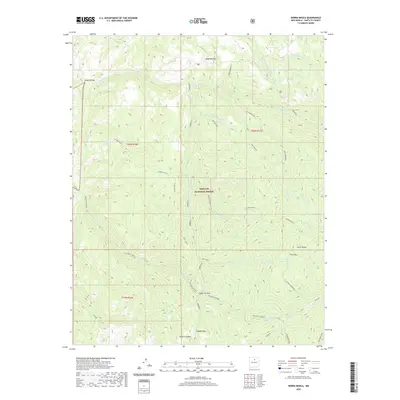
2020 Map of Sierra Mosca
USGS Topo · Published 2020About this map
Santa Fe National Forest encompasses this high-elevation landscape, where numerous drainage systems converge and diverge through steep-walled canyons. The topography is defined by significant landmarks such as Sierra Mosca and Redondo Peak, which overlook a complex network of waterways including the Rio Medio, Rio Molino, and the Rio Frijoles. This modern survey illustrates the intricate natural hydrology of the region, specifically highlighting the course of Frijoles Canyon and the notable Sierra-Mosca Trick Tank, an indicator of water management for local wildlife or livestock in this arid environment.
Find a feature on this map
28 named features on this map. Tap any name to fly to it.
Don’t see what you’re looking for? This feature index may not catch every label — zoom into the map to look around manually.
Map Details
Editions of this 2020 Sierra Mosca Map
This is the sole edition of this map. No revisions or reprints were ever made.
Other maps of this area

1889 · Santa Fe
USGS Topo · 1:125,000

1894 · Santa Fe
USGS Topo · 1:125,000

1953 · Tesuque
USGS Topo · 1:24,000

1953 · Truchas
USGS Topo · 1:24,000

1953 · Sierra Mosca
USGS Topo · 1:24,000
1953 · Cundiyo
USGS Topo · 1:24,000

1953 · Chimayo
USGS Topo · 1:24,000

1953 · Aspen Basin
USGS Topo · 1:24,000

1954 · Santa Fe
USGS Topo · 1:250,000

1954 · Raton
USGS Topo · 1:250,000