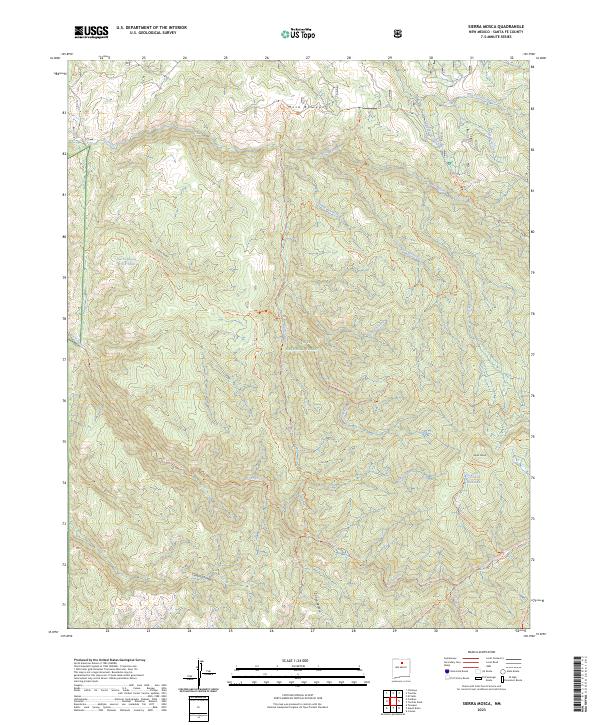
2023 Map of Sierra Mosca
USGS Topo · Published 2023About this map
Santa Fe National Forest and the high-altitude Pecos Wilderness dominate this terrain, centered on the prominent peak of Sierra Mosca. The map reveals a complex network of canyons and high mesas, where waterways like Rio Medio and Rio Frijoles have carved deep into the landscape. This 2023 survey by the U.S. Geological Survey illustrates a wild, non-residential area defined by its drainage systems and trail networks rather than human settlement. Notable features include Mesa Borrego in the north and the high meadows of Cienega Redonda to the southeast. The survey also captures vital high-country water sources such as Sarca Spring and the Sierra Mosca Trick Tank, alongside a detailed trail system including the Sierra Mosca Trl and Borrego Trl that facilitate movement through these protected lands.
Find a feature on this map
32 named features on this map. Tap any name to fly to it.
Don’t see what you’re looking for? This feature index may not catch every label — zoom into the map to look around manually.
Map Details
Editions of this 2023 Sierra Mosca Map
This is the sole edition of this map. No revisions or reprints were ever made.
Other maps of this area

1889 · Santa Fe
USGS Topo · 1:125,000

1894 · Santa Fe
USGS Topo · 1:125,000

1953 · Tesuque
USGS Topo · 1:24,000

1953 · Truchas
USGS Topo · 1:24,000

1953 · Sierra Mosca
USGS Topo · 1:24,000
1953 · Cundiyo
USGS Topo · 1:24,000

1953 · Chimayo
USGS Topo · 1:24,000

1953 · Aspen Basin
USGS Topo · 1:24,000

1954 · Santa Fe
USGS Topo · 1:250,000

1954 · Raton
USGS Topo · 1:250,000