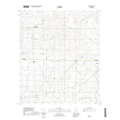
2018 Map of Sigma
USGS Topo · Published 2018About this map
Omusee Creek and its many winding tributaries like Jump-and-Run Br and Hurricane Cr define the drainage of this corner of Houston and Henry Counties. Small agricultural communities and historical crossroads are central to the landscape, including the namesake Sigma and the established settlement of Columbia near the eastern edge. For those researching local families, the map is remarkably dense with burial sites, featuring the Old Pleasant Plains Cem, Hebron Cem, and Pilgrims Rest Cem among several others. The road network, comprising a mix of county routes and local connectors like Dakota Springs Dr and Pea Market Rd, links these rural outposts. Notable water features like Smith Lake and Rivenbark Ponds dot the terrain, illustrating the hydrologic character of the Alabama panhandle borderlands during this 2018 survey.
Find a feature on this map
92 named features on this map. Tap any name to fly to it.
Don’t see what you’re looking for? This feature index may not catch every label — zoom into the map to look around manually.
Map Details
Editions of this 2018 Sigma Map
This is the sole edition of this map. No revisions or reprints were ever made.
Other maps of this area

1953 · Dothan
USGS Topo · 1:250,000

1954 · Dothan
USGS Topo · 1:250,000

1955 · Dothan
USGS Topo · 1:250,000

1969 · Dothan East
USGS Topo · 1:24,000

1969 · Headland
USGS Topo · 1:24,000

1969 · Newville
USGS Topo · 1:24,000

1970 · Gordon
USGS Topo · 1:24,000

1970 · Columbia NE
USGS Topo · 1:24,000

1970 · Haleburg
USGS Topo · 1:24,000

1970 · Sigma
USGS Topo · 1:24,000