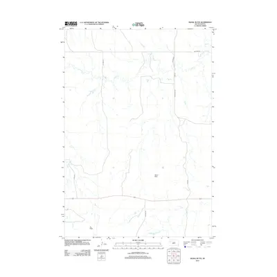
2012 Map of Signal Butte
USGS Topo · Published 2012About this map
Signal Butte stands as the primary landmark in this rural stretch of South Dakota, where the drainage patterns of Deep Cr, Lilly Cr, and Flint Cr define the landscape. This 2012 survey by the U.S. Geological Survey reveals a section of the northern plains characterized by large-scale topography and a sparse network of section-line roads. The prominent elevation of Fox Ridge stretches across the southern portion of the quadrangle, serving as a significant geographical divide. Local travel and land access are facilitated by a series of named thoroughfares such as Fox Ridge Rd, Lily Creek Rd, and Deep Creek Rd, which provide the essential framework for ranching and transport through this remote grassland environment.
Find a feature on this map
12 named features on this map. Tap any name to fly to it.
Don’t see what you’re looking for? This feature index may not catch every label — zoom into the map to look around manually.
Map Details
Editions of this 2012 Signal Butte Map
This is the sole edition of this map. No revisions or reprints were ever made.
Other maps of this area

1951 · Maurine
USGS Topo · 1:24,000

1951 · Deep Creek NW
USGS Topo · 1:24,000

1951 · Bixby
USGS Topo · 1:24,000

1952 · Deep Creek SE
USGS Topo · 1:24,000

1952 · Signal Butte
USGS Topo · 1:24,000

1952 · Deep Creek NE
USGS Topo · 1:24,000

1953 · Rapid City
USGS Topo · 1:250,000

1954 · Lemmon
USGS Topo · 1:250,000

1957 · Lemmon
USGS Topo · 1:250,000

1957 · Rapid City
USGS Topo · 1:250,000