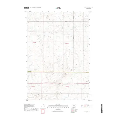
2017 Map of Signal Butte
USGS Topo · Published 2017About this map
Signal Butte rises above the high plains of the South Dakota rangeland, serving as a prominent landmark on the boundary between northern Meade and southern Perkins counties. This landscape is defined by the high elevations of Fox Ridge, which forms a drainage divide for several watercourses in the region. The map shows the winding paths of Deep Cr in the north and the headwaters of Lilly Cr and Flint Cr to the south. The sparse infrastructure reflects the area's grazing and ranching heritage, with travel largely restricted to rural corridors such as Deep Creek Rd and Co Hwy Mc-25. This 2017 survey details the section lines and township divisions that continue to govern land use in this open country.
Find a feature on this map
15 named features on this map. Tap any name to fly to it.
Don’t see what you’re looking for? This feature index may not catch every label — zoom into the map to look around manually.
Map Details
Editions of this 2017 Signal Butte Map
This is the sole edition of this map. No revisions or reprints were ever made.
Other maps of this area

1951 · Maurine
USGS Topo · 1:24,000

1951 · Deep Creek NW
USGS Topo · 1:24,000

1951 · Bixby
USGS Topo · 1:24,000

1952 · Deep Creek SE
USGS Topo · 1:24,000

1952 · Signal Butte
USGS Topo · 1:24,000

1952 · Deep Creek NE
USGS Topo · 1:24,000

1953 · Rapid City
USGS Topo · 1:250,000

1954 · Lemmon
USGS Topo · 1:250,000

1957 · Lemmon
USGS Topo · 1:250,000

1957 · Rapid City
USGS Topo · 1:250,000