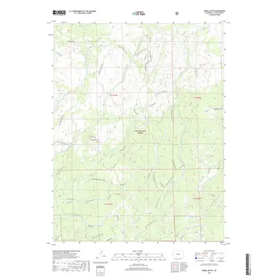
2019 Map of Signal Butte
USGS Topo · Published 2019About this map
Pike National Forest encompasses this high-elevation landscape within Teller County, defined by a complex network of drainages and prominent granite outcrops. The namesake Signal Butte and the distinctive Turkey Rock serve as major landmarks in the northwest, overlooking a terrain deeply incised by gulches and creeks. This 2019 survey reflects a landscape managed for recreation and conservation, showing an extensive system of motorized and multi-use routes including the Signal Butte Multi Use trail and various spurs like Phantom Spur and Rule Spur. Water features are concentrated in the south and east, where Ute Lake sits near the headwaters of Manchester Cr and Rule Cr. The map captures the intricate hydrography of the region, from the North Fork Davis Gulch to the seasonal flows of Quinlan Gulch and Ryan Gulch, illustrating the natural drainage patterns that have shaped this portion of the Front Range.
Find a feature on this map
35 named features on this map. Tap any name to fly to it.
Don’t see what you’re looking for? This feature index may not catch every label — zoom into the map to look around manually.
Map Details
Editions of this 2019 Signal Butte Map
This is the sole edition of this map. No revisions or reprints were ever made.
Other maps of this area

1893 · Platte Canyon
USGS Topo · 1:125,000

1894 · Pikes Peak
USGS Topo · 1:125,000

1901 · Pikes Peak
USGS Topo · 1:125,000

1901 · Pikes Peak
USGS Topo · 1:62,500

1953 · Denver
USGS Topo · 1:250,000

1954 · Mount Deception
USGS Topo · 1:24,000

1954 · Woodland Park
USGS Topo · 1:24,000

1954 · Signal Butte
USGS Topo · 1:24,000

1954 · Divide
USGS Topo · 1:24,000

1954 · Pueblo
USGS Topo · 1:250,000