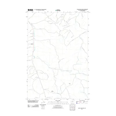
2011 Map of Signal Mountain
USGS Topo · Published 2011About this map
Signal Mountain and Elbow Hill define the high points of this terrain in Musselshell County, where the landscape is marked by a complex network of seasonal drainages and namesake roads. The drainage systems of Halfbreed Creek, Rehder Creek, and both the West Parrot Creek and East Parrot Creek carve through the area, indicating the vital importance of water sources in this environment, underscored by specifically cataloged points like 06N27E06CAB_01 Spring. Cultural markers are sparse but significant, with the Bull Mountain Vol Fire Association serving as a primary landmark. A specialized road network including Chisolm Trl and Johnnys Coal Rd suggests a history tied to land use and resource access, providing a clear view of local infrastructure and land management during the early twenty-first century.
Find a feature on this map
46 named features on this map. Tap any name to fly to it.
Don’t see what you’re looking for? This feature index may not catch every label — zoom into the map to look around manually.
Map Details
Editions of this 2011 Signal Mountain Map
This is the sole edition of this map. No revisions or reprints were ever made.
Other maps of this area

1954 · Roundup
USGS Topo · 1:250,000

1958 · Roundup
USGS Topo · 1:250,000

1979 · Roundup
USGS Topo · 1:100,000

1979 · Gage NE
USGS Topo · 1:24,000

1979 · Harper Coulee
USGS Topo · 1:24,000

1979 · Hay Basin NE
USGS Topo · 1:24,000

1979 · Gage
USGS Topo · 1:24,000

1979 · Roundup
USGS Topo · 1:24,000

1980 · Dunn Mountain South
USGS Topo · 1:24,000

1980 · Dunn Mountain North
USGS Topo · 1:24,000