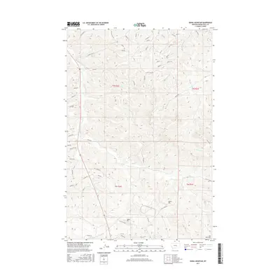
2017 Map of Signal Mountain
USGS Topo · Published 2017About this map
The Bull Mountains dominate this section of Musselshell County, where the high-altitude landscape is etched by a network of drainage creeks and named ridges. Prominent landmarks such as Signal Mtn and Elbow Hill rise above the complex topography, serving as natural waypoints in a region defined by its vertical relief. The map reveals a specific pattern of land use through its road names, which reflect both the extractive industry and the families who settled this part of Montana. For instance, routes like Johnny's Coal Rd and Pm Coal Rd point to the area's history with resource extraction, while Majerus Rd and Dillman Rd suggest the legacy of local landowners. Watercourses such as Halfbreed Cr, Rehder Cr, and E Parrot Cr carve through the terrain, illustrating the natural drainage patterns that have shaped the development and access routes of these highlands.
Find a feature on this map
51 named features on this map. Tap any name to fly to it.
Don’t see what you’re looking for? This feature index may not catch every label — zoom into the map to look around manually.
Map Details
Editions of this 2017 Signal Mountain Map
This is the sole edition of this map. No revisions or reprints were ever made.
Other maps of this area

1954 · Roundup
USGS Topo · 1:250,000

1958 · Roundup
USGS Topo · 1:250,000

1979 · Roundup
USGS Topo · 1:100,000

1979 · Gage NE
USGS Topo · 1:24,000

1979 · Harper Coulee
USGS Topo · 1:24,000

1979 · Hay Basin NE
USGS Topo · 1:24,000

1979 · Gage
USGS Topo · 1:24,000

1979 · Roundup
USGS Topo · 1:24,000

1980 · Dunn Mountain South
USGS Topo · 1:24,000

1980 · Dunn Mountain North
USGS Topo · 1:24,000