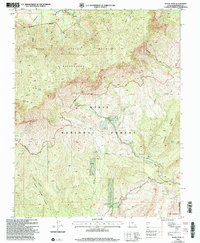
2002 Map of Signal Peak
USGS Topo · Published 2005About this map
The Pine Valley Mountains dominate this high-altitude landscape within the Dixie National Forest, reaching their apex at Signal Peak. Revised by the Forest Service at the turn of the 21st century, the map reveals a rugged backcountry interlaced with historic routes like the Whipple Trail, Summit Trail, and Oak Grove Trail. These paths connect remote landmarks such as Browns Point and Deer Flat to the springs and canyons below.
Find a feature on this map
48 named features on this map. Tap any name to fly to it.
Don’t see what you’re looking for? This feature index may not catch every label — zoom into the map to look around manually.
Map Details
Editions of this 2002 Signal Peak Map
This is the sole edition of this map. No revisions or reprints were ever made.
Other maps of this area

1885 · St. George
USGS Topo · 1:250,000

1891 · St. George
USGS Topo · 1:250,000

1953 · Cedar City
USGS Topo · 1:250,000

1954 · La Verkin 3 NW
USGS Topo · 1:24,000

1954 · La Verkin 3 NE
USGS Topo · 1:24,000

1954 · La Verkin 2 SE
USGS Topo · 1:24,000

1954 · St. George
USGS Topo · 1:62,500

1954 · Hurricane
USGS Topo · 1:62,500

1956 · St. George NE
USGS Topo · 1:24,000

1957 · New Harmony
USGS Topo · 1:62,500