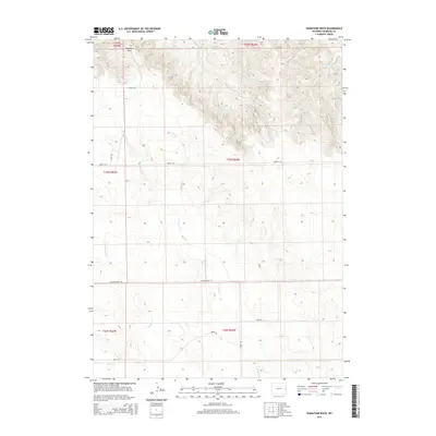
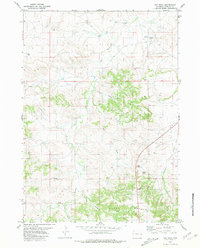
2015 Map of Signature Rock
USGS Topo · Published 2015About this map
Signature Rock stands as a prominent landmark in this corner of Niobrara County, anchoring a landscape defined by seasonal watercourses and rural thoroughfares. The drainage network is characterized by the meandering paths of N Duck Cr, Sage Cr, and Indian Cr, which cut through the high plains terrain. This 2015 survey reveals a sparse but established grid of country roads that follow the contours of the land and Section lines, notably Stage Rd and Kirtley Rd. These routes, along with Kaltenhauser Rd and Bruch Rd, serve as the primary infrastructure for the ranching and agricultural operations in the region. The map provides a precise layout of the Public Land Survey System, illustrating how township and range boundaries such as t33n r62w organize the vast, open spaces of eastern Wyoming.
Find a feature on this map
18 named features on this map. Tap any name to fly to it.
Don’t see what you’re looking for? This feature index may not catch every label — zoom into the map to look around manually.
Map Details
Editions of this 2015 Signature Rock Map
This is the sole edition of this map. No revisions or reprints were ever made.
Other maps of this area

1954 · Torrington
USGS Topo · 1:250,000

1958 · Torrington
USGS Topo · 1:250,000

1974 · Mc Master Reservoir
USGS Topo · 1:24,000
1974 · Reynolds Spring
USGS Topo · 1:24,000
1978 · Node
USGS Topo · 1:24,000

1978 · Shepherds Point
USGS Topo · 1:24,000

1978 · Kirtley SW
USGS Topo · 1:24,000

1981 · Lusk
USGS Topo · 1:24,000
1981 · Signature Rock
USGS Topo · 1:24,000
1981 · Hat Rock
USGS Topo · 1:24,000