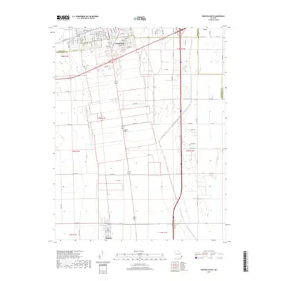
2017 Map of Sikeston South
USGS Topo · Published 2017About this map
Sikeston dominates the northern edge of this Missouri bootheel landscape, where the street grid of the city meets the organized farmland of the Mississippi Valley. The survey details the transition from urban centers like Miner and Sikeston to the rural south, including the smaller settlement of Matthews. Significant for local historians and genealogists, the map identifies several local landmarks including City Cem, Memorial Park Cem, and the Garden of Memories. The distinct elevation of Sikeston Ridge provides a natural foundation for the region's development, while the Saint Johns Ditch represents the extensive drainage efforts required to reclaim this fertile bottomland. Heavy transportation infrastructure is evident through the path of the S RR and the interstate corridor, which together have shaped the economic growth of Scott and New Madrid counties.
Find a feature on this map
63 named features on this map. Tap any name to fly to it.
Don’t see what you’re looking for? This feature index may not catch every label — zoom into the map to look around manually.
Map Details
Editions of this 2017 Sikeston South Map
This is the sole edition of this map. No revisions or reprints were ever made.
Other maps of this area

1931 · Sikeston
USGS Topo · 1:62,500

1934 · Sikeston
USGS Topo · 1:62,500

1939 · Sikeston
USGS Topo · 1:62,500

1939 · Charleston
USGS Topo · 1:62,500

1939 · New Madrid
USGS Topo · 1:62,500

1939 · Bayouville
USGS Topo · 1:62,500

1954 · Charleston
USGS Topo · 1:62,500

1954 · New Madrid
USGS Topo · 1:62,500

1955 · Bayouville
USGS Topo · 1:62,500

1956 · Dyersburg
USGS Topo · 1:250,000