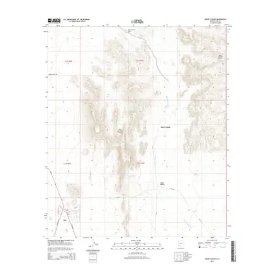
2014 Map of Sikort Chuapo
USGS Topo · Published 2014About this map
Sikort Chuapo and Hoa Murk lie within a desert landscape defined by the parallel rise of the Pozo Redondo Mountains and the Sikort Chuapo Mountains. This 2014 survey documents a region where water management is critical, evidenced by the Evelen Charco Tank and the seasonal Sikort Chuapo Wash that threads through the valley floor. To the southwest, the distinctive settlement of Why serves as a transportation hub where Az-85 meets S Highway 86 and S Sonoita Hwy. The map details the transition from the broad Valley of the Ajo into the narrower Pozo Redondo Valley, illustrating the intersection of modern road networks with traditional desert place-names and land divisions like Bia-5.
Find a feature on this map
20 named features on this map. Tap any name to fly to it.
Don’t see what you’re looking for? This feature index may not catch every label — zoom into the map to look around manually.
Map Details
Editions of this 2014 Sikort Chuapo Map
This is the sole edition of this map. No revisions or reprints were ever made.
Other maps of this area

1932 · Ajo
USGS Topo · 1:62,500

1934 · Ajo
USGS Topo · 1:62,500

1953 · Ajo
USGS Topo · 1:250,000

1957 · Ajo
USGS Topo · 1:250,000

1958 · Ajo
USGS Topo · 1:250,000

1962 · Ajo
USGS Topo · 1:250,000

1963 · Ajo
USGS Topo · 1:250,000

1963 · Ajo
USGS Topo · 1:62,500

1963 · Sikort Chuapo Mts
USGS Topo · 1:62,500

1963 · Mt. Ajo
USGS Topo · 1:62,500