
1974 Map of Silas
USGS Topo · Published 1977About this map
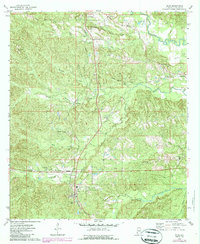
Bolinger and Silas anchor the southern portion of this Choctaw County landscape, where the St Louis-San Francisco railroad cuts a north-south line through the timbered terrain. The northern reaches near Gilbertown show an active extraction economy, marked by several Oil Wells and a Sandpit situated between Little Mill Creek and Mill Creek. This 1974 field-checked survey reveals a high density of rural religious and burial sites that serve as vital markers for local family history, including Springbank Cem, Harrison Cem, and the Seventh-day Adventist Cem.
Find a feature on this map
43 named features on this map. Tap any name to fly to it.
Don’t see what you’re looking for? This feature index may not catch every label — zoom into the map to look around manually.
Map Details
Editions of this 1974 Silas Map
2 editions found
Other maps of this area

1953 · Hattiesburg
USGS Topo · 1:250,000

1958 · Hattiesburg
USGS Topo · 1:250,000

1971 · Ararat
USGS Topo · 1:24,000

1971 · Bladon Springs
USGS Topo · 1:24,000

1971 · Coffeeville Lock And Dam
USGS Topo · 1:24,000

1974 · Melvin
USGS Topo · 1:24,000

1974 · Millry North
USGS Topo · 1:24,000

1974 · Isney
USGS Topo · 1:24,000
1974 · Aquilla
USGS Topo · 1:24,000
1974 · Toxey
USGS Topo · 1:24,000