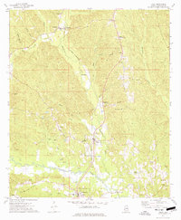
1974 Map of Toxey
USGS Topo · Published 1977About this map
Toxey and Gilbertown anchor this mid-1970s survey of central Choctaw County, where the industrial presence of the Choctaw Ridge Oil Field and Toxey Oil Field contrasts with the area's rural spiritual and educational landmarks. The landscape is deeply influenced by the path of the St Louis - San Francisco railroad and the historic Indian Treaty Boundary which cuts across the terrain near Hodgewood. For genealogists and local historians, the map is a dense record of community life, noting institutions like the South Choctaw Academy and a variety of country churches including Oak Grove Ch, New Hope Ch, and the Old Lusk Tabernacle. Multiple watercourses, such as Okatuppa Creek and Bogue Loosa Creek, define the topography and drainage patterns of this resource-rich Alabama corridor.
Find a feature on this map
47 named features on this map. Tap any name to fly to it.
Don’t see what you’re looking for? This feature index may not catch every label — zoom into the map to look around manually.
Map Details
Editions of this 1974 Toxey Map
2 editions found
Other maps of this area

1953 · Hattiesburg
USGS Topo · 1:250,000

1953 · Meridian
USGS Topo · 1:250,000

1957 · Meridian
USGS Topo · 1:250,000

1958 · Hattiesburg
USGS Topo · 1:250,000

1965 · Meridian
USGS Topo · 1:250,000

1971 · Ararat
USGS Topo · 1:24,000

1971 · Coffeeville Lock And Dam
USGS Topo · 1:24,000

1974 · Melvin
USGS Topo · 1:24,000

1974 · Silas
USGS Topo · 1:24,000

1974 · Isney
USGS Topo · 1:24,000