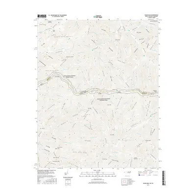
2016 Map of Silers Bald
USGS Topo · Published 2016About this map
Great Smoky Mountains National Park encompasses this entire high-altitude landscape, where the state boundary between Tennessee and North Carolina follows the winding ridge crest. The Appalachian National Scenic Trail serves as the primary artery for movement through this wilderness, traversing critical landmarks like Silers Bald and the precarious section known as The Narrows. This topography is defined by significant elevation changes, from the heights of Clingmans Dome and Blanket Mountain to the deeply carved drainages of the Little River and Fish Camp Prong. The network of historical paths, including the Miry Ridge Trail and Welch Ridge Trail, reveals the traditional routes used to navigate the complex system of leads and ridges like Silers Lead and Goshen Ridge. A rare point of genealogical interest in this protected backcountry is Wike Cem, located near the intersection of several secondary drainages.
Find a feature on this map
142 named features on this map. Tap any name to fly to it.
Don’t see what you’re looking for? This feature index may not catch every label — zoom into the map to look around manually.
Map Details
Editions of this 2016 Silers Bald Map
This is the sole edition of this map. No revisions or reprints were ever made.
Other maps of this area

1886 · Knoxville
USGS Topo · 1:125,000

1891 · Cowee
USGS Topo · 1:125,000

1892 · Knoxville
USGS Topo · 1:125,000

1893 · Mt Guyot
USGS Topo · 1:125,000

1894 · Knoxville
USGS Topo · 1:125,000

1895 · Knoxville
USGS Topo · 1:125,000

1897 · Cowee
USGS Topo · 1:125,000

1901 · Knoxville
USGS Topo · 1:125,000

1907 · Cowee
USGS Topo · 1:125,000

1912 · Mt Guyot
USGS Topo · 1:125,000