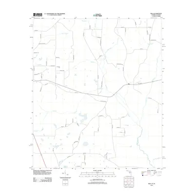
2012 Map of Sills
USGS Topo · Published 2012About this map
The Chipola River winds through this landscape on the Florida-Alabama border, anchoring a region of complex hydrology and rural settlement. The community of Sills serves as a central point, situated near Hart Airport and the confluence of several small waterways. The terrain is defined by a series of springs and seasonal water bodies, including Daniel Springs, the broad Waddells Mill Pond, and the secluded Open Pond. Local history and family roots are tied to the many named roads such as Christmas Rd and Ephesus Church Rd, which lead to long-standing landmarks like Friendship Cem. The drainage patterns of Cowarts Cr and Moulten Slough illustrate the low-lying, water-rich nature of the Panhandle interior. This survey provides a precise view of the rural infrastructure and natural springs before more modern developments altered the local character.
Find a feature on this map
62 named features on this map. Tap any name to fly to it.
Don’t see what you’re looking for? This feature index may not catch every label — zoom into the map to look around manually.
Map Details
Editions of this 2012 Sills Map
This is the sole edition of this map. No revisions or reprints were ever made.
Other maps of this area

1952 · Cottondale East
USGS Topo · 1:24,000

1952 · Malone
USGS Topo · 1:24,000

1952 · Campbellton
USGS Topo · 1:24,000

1952 · Cottondale West
USGS Topo · 1:24,000

1952 · Sills
USGS Topo · 1:24,000

1952 · Marianna
USGS Topo · 1:24,000

1953 · Dothan
USGS Topo · 1:250,000

1954 · Dothan
USGS Topo · 1:250,000

1954 · Tallahassee
USGS Topo · 1:250,000

1955 · Dothan
USGS Topo · 1:250,000