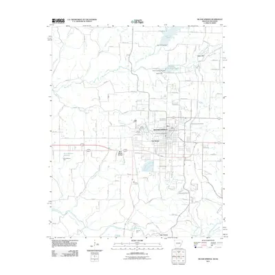
2011 Map of Siloam Springs
USGS Topo · Published 2011About this map
Siloam Springs anchors this landscape at the intersection of Arkansas and Oklahoma, serving as a regional hub defined by education and water resources. The campus of John Brown University is a central feature of the city's western edge, while the older core of the community includes Hico and Greenwood. The area is notably dense with burial grounds for genealogists to explore, including the Oak Hill Cemetery, Gunter Cemetery, and Old Baptist Cemetery.
Find a feature on this map
109 named features on this map. Tap any name to fly to it.
Don’t see what you’re looking for? This feature index may not catch every label — zoom into the map to look around manually.
Map Details
Editions of this 2011 Siloam Springs Map
This is the sole edition of this map. No revisions or reprints were ever made.
Other maps of this area

1899 · Fayetteville
USGS Topo · 1:125,000

1899 · Siloam Springs
USGS Topo · 1:125,000

1901 · Fayetteville
USGS Topo · 1:125,000

1903 · Siloam Springs
USGS Topo · 1:125,000

1904 · Siloam Springs
USGS Topo · 1:125,000

1904 · Fayetteville
USGS Topo · 1:125,000

1954 · Tulsa
USGS Topo · 1:250,000

1958 · Tulsa
USGS Topo · 1:250,000

1963 · Tulsa
USGS Topo · 1:250,000

1970 · Gallatin
USGS Topo · 1:24,000