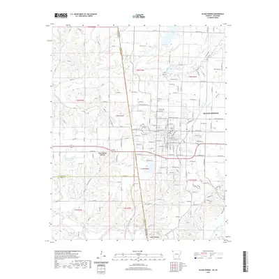
2020 Map of Siloam Springs
USGS Topo · Published 2020About this map
Siloam Springs anchors this recent survey of the Arkansas-Oklahoma border, where the town’s residential and academic sectors meet the Ozark foothills. The campus of John Brown University sits centrally, surrounded by historic burial grounds including Oak Hill Cem and Old Baptist Cem. The landscape is defined by its water systems, from the northern Lake Flint Creek down to Lake Frances on the Illinois River. To the west, West Siloam Springs extends into Oklahoma, illustrating the cross-border connectivity of the region. Local history is traced through numerous small cemeteries like Blagg Cem and Bell Cem, while the hydrological network includes Sager Cr and the Perry Williams Reservoir, reflecting a terrain shaped by consistent water management and civic growth.
Find a feature on this map
177 named features on this map. Tap any name to fly to it.
Don’t see what you’re looking for? This feature index may not catch every label — zoom into the map to look around manually.
Map Details
Editions of this 2020 Siloam Springs Map
This is the sole edition of this map. No revisions or reprints were ever made.
Other maps of this area

1899 · Fayetteville
USGS Topo · 1:125,000

1899 · Siloam Springs
USGS Topo · 1:125,000

1901 · Fayetteville
USGS Topo · 1:125,000

1903 · Siloam Springs
USGS Topo · 1:125,000

1904 · Siloam Springs
USGS Topo · 1:125,000

1904 · Fayetteville
USGS Topo · 1:125,000

1954 · Tulsa
USGS Topo · 1:250,000

1958 · Tulsa
USGS Topo · 1:250,000

1963 · Tulsa
USGS Topo · 1:250,000

1970 · Gallatin
USGS Topo · 1:24,000