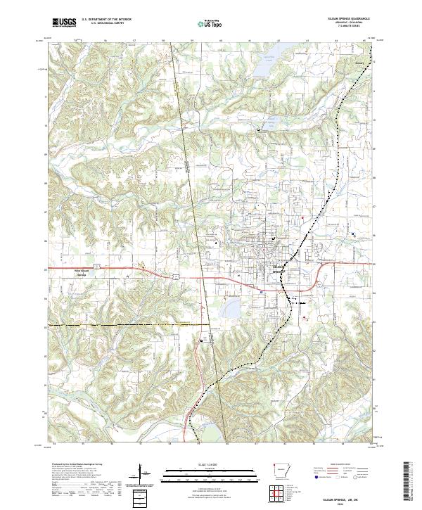
2024 Map of Siloam Springs
USGS Topo · Published 2024About this map
Siloam Springs and its neighboring community, West Siloam Springs, straddle the state line where Northwest Arkansas meets Oklahoma. This 2024 survey captures a well-established landscape defined by the winding course of the Illinois River and Flint Creek, which feeds into Lake Flint Creek near the northern border at Gentry. The area's character is shaped by a mix of educational institutions, such as John Brown University, and numerous local burial grounds that mark the region's long settlement history. Local researchers can identify the footprints of several community landmarks, including Oak Hill Cem, Blagg Cem, and the Old Baptist Cem. The topography is etched with small waterways like Sager Creek and Beaver Creek, reflecting the traditional drainage patterns that have guided development in both Benton and Delaware counties for generations.
Find a feature on this map
181 named features on this map. Tap any name to fly to it.
Don’t see what you’re looking for? This feature index may not catch every label — zoom into the map to look around manually.
Map Details
Editions of this 2024 Siloam Springs Map
This is the sole edition of this map. No revisions or reprints were ever made.
Other maps of this area

1899 · Fayetteville
USGS Topo · 1:125,000

1899 · Siloam Springs
USGS Topo · 1:125,000

1901 · Fayetteville
USGS Topo · 1:125,000

1903 · Siloam Springs
USGS Topo · 1:125,000

1904 · Siloam Springs
USGS Topo · 1:125,000

1904 · Fayetteville
USGS Topo · 1:125,000

1954 · Tulsa
USGS Topo · 1:250,000

1958 · Tulsa
USGS Topo · 1:250,000

1963 · Tulsa
USGS Topo · 1:250,000

1970 · Gallatin
USGS Topo · 1:24,000