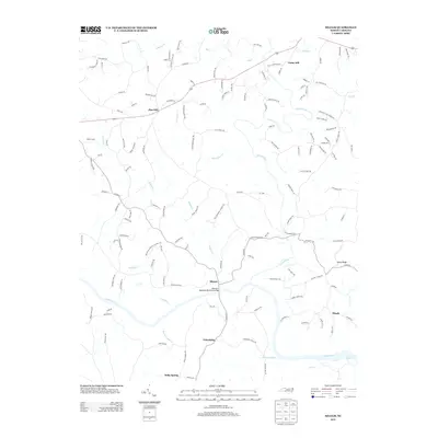
2013 Map of Siloam
USGS Topo · Published 2013About this map
The Ararat River flows south through the heart of this North Carolina landscape to its confluence with the Yadkin River, a waterway that historically defined the region's southern boundary. Near the center, the settlement of Siloam serves as a focal point, connected across the water by the Atkinson- Needham Memorial Bridge. The area is characterized by a network of creek systems including Skin Cabin Cr, Hogan Cr, and Candiff Cr, which carve through the terrain toward the larger river basins.
Find a feature on this map
142 named features on this map. Tap any name to fly to it.
Don’t see what you’re looking for? This feature index may not catch every label — zoom into the map to look around manually.
Map Details
Editions of this 2013 Siloam Map
This is the sole edition of this map. No revisions or reprints were ever made.
Other maps of this area

1891 · Yadkinville
USGS Topo · 1:125,000

1893 · Yadkinville
USGS Topo · 1:125,000

1953 · Winston-Salem
USGS Topo · 1:250,000

1955 · Winston-Salem
USGS Topo · 1:250,000

1962 · Winston-Salem
USGS Topo · 1:250,000

1964 · Pinnacle
USGS Topo · 1:24,000

1964 · Pilot Mountain
USGS Topo · 1:24,000

1966 · Yadkinville
USGS Topo · 1:24,000

1966 · East Bend
USGS Topo · 1:24,000
1968 · Vienna
USGS Topo · 1:24,000