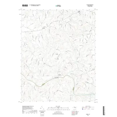
2019 Map of Siloam
USGS Topo · Published 2019About this map
The Yadkin River and Ararat River converge near the settlement of Siloam, forming a central geography defined by water power and historical crossings. This area along the Surry and Yadkin county line shows a landscape deeply connected to its rural roots, evidenced by the numerous family and community burial grounds such as the Fulk and Shore Graveyard, Siloam Cem, and Friendship Cem. The Atkinson-Needham Memorial Bridge provides a vital link across the Yadkin, connecting the northern communities to the southern bank near Shoals.
Find a feature on this map
136 named features on this map. Tap any name to fly to it.
Don’t see what you’re looking for? This feature index may not catch every label — zoom into the map to look around manually.
Map Details
Editions of this 2019 Siloam Map
This is the sole edition of this map. No revisions or reprints were ever made.
Other maps of this area

1891 · Yadkinville
USGS Topo · 1:125,000

1893 · Yadkinville
USGS Topo · 1:125,000

1953 · Winston-Salem
USGS Topo · 1:250,000

1955 · Winston-Salem
USGS Topo · 1:250,000

1962 · Winston-Salem
USGS Topo · 1:250,000

1964 · Pinnacle
USGS Topo · 1:24,000

1964 · Pilot Mountain
USGS Topo · 1:24,000

1966 · Yadkinville
USGS Topo · 1:24,000

1966 · East Bend
USGS Topo · 1:24,000
1968 · Vienna
USGS Topo · 1:24,000