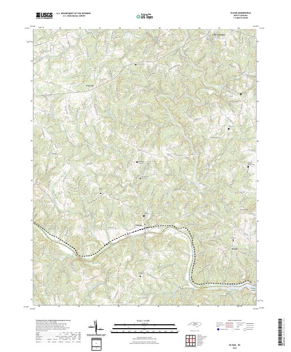
2022 Map of Siloam
USGS Topo · Published 2022About this map
The Yadkin River serves as the defining southern boundary for this portion of the North Carolina piedmont, where the terrain transitions toward the distinctive profile of Pilot Mountain in the north. The small community of Siloam sits near the riverbanks, acting as a historical focal point for the surrounding network of rural roads and family-named landmarks. The landscape is characterized by a dense system of waterways, including the Ararat River, Hogan Cr, and Candiff Cr, which have historically dictated the placement of homesteads and small settlements like Shoals and Pine Hill.
Find a feature on this map
132 named features on this map. Tap any name to fly to it.
Don’t see what you’re looking for? This feature index may not catch every label — zoom into the map to look around manually.
Map Details
Editions of this 2022 Siloam Map
This is the sole edition of this map. No revisions or reprints were ever made.
Other maps of this area

1891 · Yadkinville
USGS Topo · 1:125,000

1893 · Yadkinville
USGS Topo · 1:125,000

1953 · Winston-Salem
USGS Topo · 1:250,000

1955 · Winston-Salem
USGS Topo · 1:250,000

1962 · Winston-Salem
USGS Topo · 1:250,000

1964 · Pinnacle
USGS Topo · 1:24,000

1964 · Pilot Mountain
USGS Topo · 1:24,000

1966 · Yadkinville
USGS Topo · 1:24,000

1966 · East Bend
USGS Topo · 1:24,000
1968 · Vienna
USGS Topo · 1:24,000