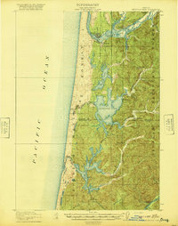
1920 Map of Siltcoos Lake
USGS Topo · Published 1920About this map
The Siuslaw River and its interaction with the Pacific Ocean dominate this coastal landscape, where the town of Florence sits near the river's mouth. This survey, conducted just after World War I, reveals a region defined by its massive freshwater bodies separated from the sea by a narrow coastal strip of the Siuslaw National Forest. The rail-dependent economy of the era is evident along the Southern Pacific line, which services small settlements and stations like Cushman Sta and Ada Sta.
Find a feature on this map
37 named features on this map. Tap any name to fly to it.
Don’t see what you’re looking for? This feature index may not catch every label — zoom into the map to look around manually.
Map Details
Editions of this 1920 Siltcoos Lake Map
3 editions found
Other maps of this area

1918 · Mapleton
USGS Topo · 1:48,000

1919 · Earl
USGS Topo · 1:48,000

1920 · Siltcoos Lake
USGS Topo · 1:62,500

1920 · Heceta Head
USGS Topo · 1:62,500

1923 · Reedsport
USGS Topo · 1:62,500

1940 · Mapleton
USGS Topo · 1:62,500

1941 · Siltcoos Lake
USGS Topo · 1:62,500

1942 · Heceta Head
USGS Topo · 1:62,500

1942 · Siltcoos Lake
USGS Topo · 1:62,500

1942 · Reedsport
USGS Topo · 1:62,500