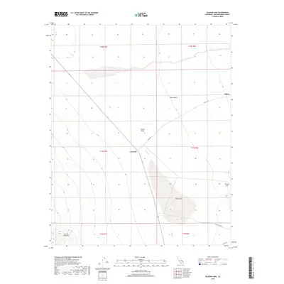
2018 Map of Silurian Lake
USGS Topo · Published 2018About this map
Silurian Lake dominates the basin of this high desert landscape, located within the vast expanse of the Mojave Desert. The dry lake bed sits at the center of the Silurian Valley, flanked by the rising elevations of the Avawatz Mountains to the southwest and the Silurian Hills to the southeast. This 2018 survey reveals the minimalist infrastructure of this arid region, where state and county routes provide the only access to remote outposts. The ephemeral Salt Cr cuts through the northern valley floor, illustrating the drainage patterns that define this desert sink. Small settlements like Renoville and Valjean represent the sparse human footprint in a territory largely defined by its geology and the grid lines of the Public Land Survey System, including t17n r7e and t18n r8e.
Find a feature on this map
17 named features on this map. Tap any name to fly to it.
Don’t see what you’re looking for? This feature index may not catch every label — zoom into the map to look around manually.
Map Details
Editions of this 2018 Silurian Lake Map
This is the sole edition of this map. No revisions or reprints were ever made.
Other maps of this area

1933 · Avawatz Mountains
USGS Topo · 1:250,000

1947 · Trona
USGS Topo · 1:250,000

1948 · Red Pass Lake
USGS Topo · 1:62,500

1948 · Trona
USGS Topo · 1:250,000

1948 · Avawatz Pass
USGS Topo · 1:62,500

1951 · Avawatz Pass
USGS Topo · 1:62,500

1951 · Red Pass Lake
USGS Topo · 1:62,500

1953 · Trona
USGS Topo · 1:250,000

1956 · Silurian Hills
USGS Topo · 1:62,500

1956 · Baker
USGS Topo · 1:62,500