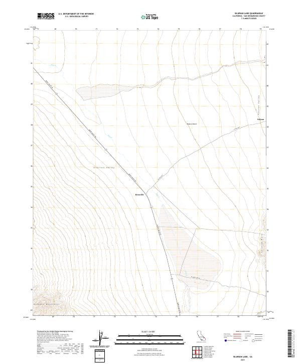
2021 Map of Silurian Lake
USGS Topo · Published 2021About this map
Silurian Valley and its surrounding desert ranges dominate this landscape in the eastern Mojave Desert. The topography is defined by the stark transition from the Avawatz Mountains in the southwest to the broad, flat reaches of the valley floor, where the ephemeral Salt Cr drains toward the central basin. Human presence is concentrated along the arterial Death Valley Rd, which bisects the quadrangle and provides access to the small settlement of Renoville. To the east, the Silurian Hills and Valjean Valley frame the former rail siding of Valjean, reflecting the historical transportation corridors that once utilized these low-gradient desert passes. This modern survey illustrates the enduring spatial relationship between these isolated outposts and the prominent geographic features of San Bernardino County.
Find a feature on this map
18 named features on this map. Tap any name to fly to it.
Don’t see what you’re looking for? This feature index may not catch every label — zoom into the map to look around manually.
Map Details
Editions of this 2021 Silurian Lake Map
This is the sole edition of this map. No revisions or reprints were ever made.
Other maps of this area

1933 · Avawatz Mountains
USGS Topo · 1:250,000

1947 · Trona
USGS Topo · 1:250,000

1948 · Red Pass Lake
USGS Topo · 1:62,500

1948 · Trona
USGS Topo · 1:250,000

1948 · Avawatz Pass
USGS Topo · 1:62,500

1951 · Avawatz Pass
USGS Topo · 1:62,500

1951 · Red Pass Lake
USGS Topo · 1:62,500

1953 · Trona
USGS Topo · 1:250,000

1956 · Silurian Hills
USGS Topo · 1:62,500

1956 · Baker
USGS Topo · 1:62,500