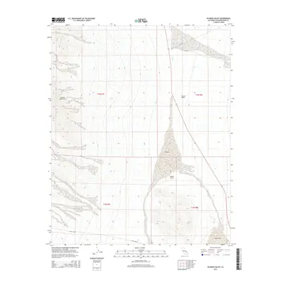
2015 Map of Silurian Valley
USGS Topo · Published 2015About this map
Avawatz Mountains rise sharply along the western edge of this desert landscape, casting their shadow over the Silurian Valley as it descends into the broader Mojave Desert. This terrain is defined by its arid drainage patterns, most notably the expansive Dry Lake and the southern reach of Silver Lake. These ephemeral basins are connected by the seasonal flow of Salt Cr, illustrating the hydrological cycles of the high desert. Settlement is absent here, with the human footprint limited to the thin lines of Silver Lake Rd and Riggs Rd which skirt the edges of the valley. The map documents a landscape where natural topography and seasonal water features dictate the movement of travelers through this unpopulated corridor of San Bernardino County.
Find a feature on this map
13 named features on this map. Tap any name to fly to it.
Don’t see what you’re looking for? This feature index may not catch every label — zoom into the map to look around manually.
Map Details
Editions of this 2015 Silurian Valley Map
This is the sole edition of this map. No revisions or reprints were ever made.
Other maps of this area

1933 · Avawatz Mountains
USGS Topo · 1:250,000

1947 · Trona
USGS Topo · 1:250,000

1948 · Red Pass Lake
USGS Topo · 1:62,500

1948 · Trona
USGS Topo · 1:250,000

1948 · Avawatz Pass
USGS Topo · 1:62,500

1951 · Avawatz Pass
USGS Topo · 1:62,500

1951 · Red Pass Lake
USGS Topo · 1:62,500

1953 · Trona
USGS Topo · 1:250,000

1956 · Silurian Hills
USGS Topo · 1:62,500

1956 · Baker
USGS Topo · 1:62,500