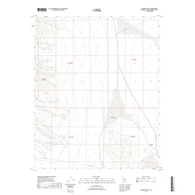
2018 Map of Silurian Valley
USGS Topo · Published 2018About this map
The eastern foothills of the Avawatz Mountains meet the vast drainage systems of the north-central Mojave Desert in this high-altitude topographic study. The landscape is dominated by the broad, arid expanse of the Silurian Valley, where the ephemeral Salt Creek (also labeled Salt Cr) flows northward through a wide wash system. This drainage is joined by Riggs Wash in the northeastern quadrant, illustrating the complex alluvial patterns characteristic of the region's hydrography. Human presence is defined primarily by utility and transport corridors. Silver Lake Rd and Riggs Rd provide essential access across the desert floor, while Powerline Rd cuts across the southern portion of the valley. These routes trace the historical and modern infrastructure paths that connect the remote basins between mountain ranges.
Find a feature on this map
14 named features on this map. Tap any name to fly to it.
Don’t see what you’re looking for? This feature index may not catch every label — zoom into the map to look around manually.
Map Details
Editions of this 2018 Silurian Valley Map
This is the sole edition of this map. No revisions or reprints were ever made.
Other maps of this area

1933 · Avawatz Mountains
USGS Topo · 1:250,000

1947 · Trona
USGS Topo · 1:250,000

1948 · Red Pass Lake
USGS Topo · 1:62,500

1948 · Trona
USGS Topo · 1:250,000

1948 · Avawatz Pass
USGS Topo · 1:62,500

1951 · Avawatz Pass
USGS Topo · 1:62,500

1951 · Red Pass Lake
USGS Topo · 1:62,500

1953 · Trona
USGS Topo · 1:250,000

1956 · Silurian Hills
USGS Topo · 1:62,500

1956 · Baker
USGS Topo · 1:62,500