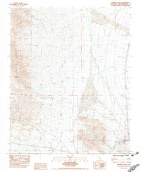
1983 Map of Silurian Valley
USGS Topo · Published 1983About this map
The Silurian Valley floor dominates this landscape, defined by the stark drainage patterns of Salt Creek and the expansive Dry Sand Lake. To the west, the steep alluvial fans of the Avawatz Mountains spill into the basin, while the southern edge is marked by the Soda Mountains near the ephemeral Silver Lake. A clear human imprint remains in the form of an Old Railroad Grade running along the eastern edge of the valley, a relic of early 20th-century desert transit. The map also records several Borrow Pits and Transmission Lines, indicating the region's utility as a corridor for infrastructure despite the prevalence of Dry Wash and Dry Sand Wash features that characterize this arid environment.
Find a feature on this map
14 named features on this map. Tap any name to fly to it.
Don’t see what you’re looking for? This feature index may not catch every label — zoom into the map to look around manually.
Map Details
Editions of this 1983 Silurian Valley Map
This is the sole edition of this map. No revisions or reprints were ever made.
Other maps of this area

1933 · Avawatz Mountains
USGS Topo · 1:250,000

1947 · Trona
USGS Topo · 1:250,000

1948 · Red Pass Lake
USGS Topo · 1:62,500

1948 · Trona
USGS Topo · 1:250,000

1948 · Avawatz Pass
USGS Topo · 1:62,500

1951 · Avawatz Pass
USGS Topo · 1:62,500

1951 · Red Pass Lake
USGS Topo · 1:62,500

1953 · Trona
USGS Topo · 1:250,000

1956 · Silurian Hills
USGS Topo · 1:62,500

1956 · Baker
USGS Topo · 1:62,500