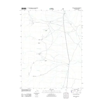
2012 Map of Silver Canyon
USGS Topo · Published 2012About this map
Siegel Ranch and Pierce Ranch anchor this high-desert landscape in White Pine County, showing the persistent ranching operations that utilize the drainage of Siegel Cr and Spring Valley Cr. The industrial legacy of the region is centered at the Aurum Mill site near Silver Canyon, a point of interest for those tracing the mining and processing history of the eastern Nevada ranges. The map reveals a network of natural water sources vital to this arid environment, including Osborne Springs, Willow Spring, and the curiously named Mud Springs. The presence of McCurdy Garden and Negro Abes suggests specific historical land use and named locations that serve as critical markers for genealogists and local historians documenting the early families and pioneers of the Spring Valley area.
Find a feature on this map
27 named features on this map. Tap any name to fly to it.
Don’t see what you’re looking for? This feature index may not catch every label — zoom into the map to look around manually.
Map Details
Editions of this 2012 Silver Canyon Map
This is the sole edition of this map. No revisions or reprints were ever made.
Other maps of this area

1956 · Ely
USGS Topo · 1:250,000

1959 · Ely
USGS Topo · 1:250,000

1963 · Ely
USGS Topo · 1:250,000
1982 · Kalamazoo Creek
USGS Topo · 1:24,000
1982 · Silver Canyon
USGS Topo · 1:24,000
1982 · Stonehouse
USGS Topo · 1:24,000
1982 · Schellbourne
USGS Topo · 1:24,000
1982 · Mattier Creek
USGS Topo · 1:24,000
1982 · Kalamazoo Summit
USGS Topo · 1:24,000
1986 · Big Hard Pan
USGS Topo · 1:24,000