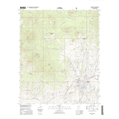
2017 Map of Silver City
USGS Topo · Published 2017About this map
Silver City serves as the hub of this Southwestern high-country landscape, where the urban grid meets the foothills of the Gila National Forest. The presence of the Cleveland Mine and the prominent Boston Hill to the south underscores the area's deep-rooted mining identity, while Western New Mexico University marks the town's evolution into an educational center. To the west and north, the terrain rises sharply toward the Continental Divide, with landmarks such as Stewart Peak, Gomez Peak, and Bear Mtn defining the horizon.
Find a feature on this map
171 named features on this map. Tap any name to fly to it.
Don’t see what you’re looking for? This feature index may not catch every label — zoom into the map to look around manually.
Map Details
Editions of this 2017 Silver City Map
This is the sole edition of this map. No revisions or reprints were ever made.
Other maps of this area

1909 · Silver City
USGS Topo · 1:125,000

1947 · Twin Sisters
USGS Topo · 1:24,000

1947 · Fort Bayard
USGS Topo · 1:24,000

1948 · Twin Sisters
USGS Topo · 1:24,000

1949 · Fort Bayard
USGS Topo · 1:24,000

1949 · Hurley West
USGS Topo · 1:24,000

1949 · Circle Mesa
USGS Topo · 1:24,000

1950 · Tyrone
USGS Topo · 1:24,000

1950 · Dorsey Ranch
USGS Topo · 1:24,000

1950 · Wind Mountain
USGS Topo · 1:24,000