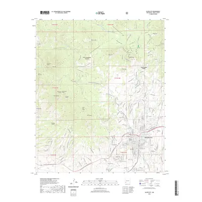
2020 Map of Silver City
USGS Topo · Published 2020About this map
Silver City serves as the focal point of this Grant County survey, where the urban grid meets the high desert terrain of the Gila National Forest. The map illustrates the town's institutional heart, including the Western New Mexico University campus and the Grant County Courthouse. To the west and south, the legacy of the region's extractive history is evident at Chloride Flat and the Lukens Mine, while Boston Hill stands at the city's edge.
Find a feature on this map
186 named features on this map. Tap any name to fly to it.
Don’t see what you’re looking for? This feature index may not catch every label — zoom into the map to look around manually.
Map Details
Editions of this 2020 Silver City Map
This is the sole edition of this map. No revisions or reprints were ever made.
Other maps of this area

1909 · Silver City
USGS Topo · 1:125,000

1947 · Twin Sisters
USGS Topo · 1:24,000

1947 · Fort Bayard
USGS Topo · 1:24,000

1948 · Twin Sisters
USGS Topo · 1:24,000

1949 · Fort Bayard
USGS Topo · 1:24,000

1949 · Hurley West
USGS Topo · 1:24,000

1949 · Circle Mesa
USGS Topo · 1:24,000

1950 · Tyrone
USGS Topo · 1:24,000

1950 · Dorsey Ranch
USGS Topo · 1:24,000

1950 · Wind Mountain
USGS Topo · 1:24,000