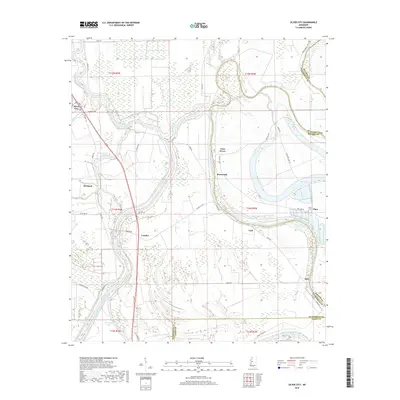
2018 Map of Silver City
USGS Topo · Published 2018About this map
The Yazoo River defines the western edge of this landscape, its serpentine path mirrored by numerous oxbows and swampy depressions typical of the Delta. This survey captures a rural Mississippi environment characterized by scattered crossroads communities such as Lamkin, Pluto, and Hidi. The eastern half is dominated by Bee Lake and Tchula Lake, long narrow bodies of water that follow former river channels. In the south, substantial water control projects are evident with the Will-M-Whittington Auxiliary Channel cutting through the lowlands near Big Kilby Lake. For genealogists, the map identifies specific local burial sites including Jones Cem and Pluto Cem. The settlement pattern follows the high ground along Levee Rd and River Rd, showing the continued importance of river-adjacent infrastructure in Silver City and the surrounding townships.
Find a feature on this map
49 named features on this map. Tap any name to fly to it.
Don’t see what you’re looking for? This feature index may not catch every label — zoom into the map to look around manually.
Map Details
Editions of this 2018 Silver City Map
This is the sole edition of this map. No revisions or reprints were ever made.
Other maps of this area

1940 · Auter
USGS Topo · 1:62,500

1940 · Mileston
USGS Topo · 1:62,500

1953 · Greenwood
USGS Topo · 1:250,000

1954 · Mileston
USGS Topo · 1:62,500

1955 · Jackson
USGS Topo · 1:250,000

1956 · Greenwood
USGS Topo · 1:250,000

1961 · Jackson
USGS Topo · 1:250,000

1961 · Bayland
USGS Topo · 1:62,500

1961 · Valley
USGS Topo · 1:62,500

1962 · Jackson
USGS Topo · 1:250,000