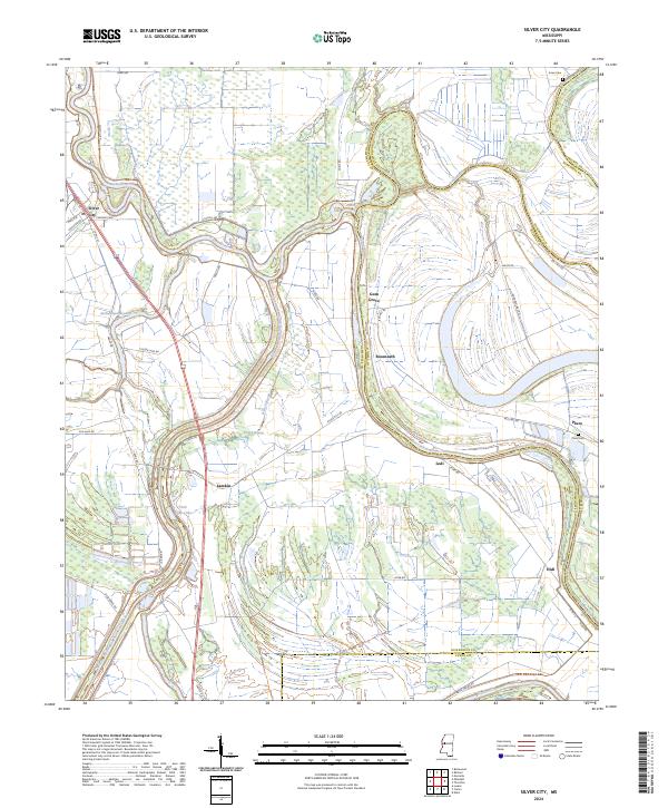
2024 Map of Silver City
USGS Topo · Published 2024About this map
The Yazoo River snakes through a dense network of bayous and wetlands where Humphreys, Holmes, and Yazoo counties converge. This riverine landscape is defined by its conservation areas, notably the Theodore Roosevelt National Wildlife Refuge and the Panther Swamp National Wildlife Refuge, which dominate the southern and central terrain. Human engineering is evident in the Will M Whittington Auxiliary Channel, a major flood control feature that cuts across the natural drainage of French Bayou and Atchafalaya Bayou. Small rural communities and historic landings dot the higher ground near the riverbanks, including the namesake Silver City and the settlement of Pluto. These areas provide valuable points of reference for local historians, with landmarks like Pluto Cem and Jones Cem preserved amidst the shifting waters of Tchula Lake and Little Kilby Lake.
Find a feature on this map
49 named features on this map. Tap any name to fly to it.
Don’t see what you’re looking for? This feature index may not catch every label — zoom into the map to look around manually.
Map Details
Editions of this 2024 Silver City Map
This is the sole edition of this map. No revisions or reprints were ever made.
Other maps of this area

1940 · Auter
USGS Topo · 1:62,500

1940 · Mileston
USGS Topo · 1:62,500

1953 · Greenwood
USGS Topo · 1:250,000

1954 · Mileston
USGS Topo · 1:62,500

1955 · Jackson
USGS Topo · 1:250,000

1956 · Greenwood
USGS Topo · 1:250,000

1961 · Jackson
USGS Topo · 1:250,000

1961 · Bayland
USGS Topo · 1:62,500

1961 · Valley
USGS Topo · 1:62,500

1962 · Jackson
USGS Topo · 1:250,000