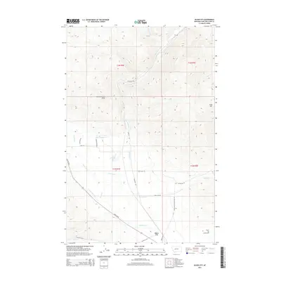
2014 Map of Silver City
USGS Topo · Published 2014About this map
Silver City sits at the junction of the mountain front and the valley floor, where the Lewis and Clark Range meets the plains of Lewis and Clark County. This 2014 survey documents a complex irrigation landscape defined by the Vincent Ditch, Justisson Ditch, and Gans Klein Ditch, which divert water from mountain-fed streams like Little Prickly Pear Cr and Trinity Cr to support the local ranching economy. The terrain rises sharply to the east toward Baldy Mtn, while the southern reaches of the map show traces of the region's mining heritage near Luck Gulch and the Trust-to- mine site. These landmarks, along with a network of rural routes such as Marysville Rd E and Lincoln Rd W, reflect a community built on a foundation of hydraulic engineering and mineral extraction that has persisted into the 21st century.
Find a feature on this map
28 named features on this map. Tap any name to fly to it.
Don’t see what you’re looking for? This feature index may not catch every label — zoom into the map to look around manually.
Map Details
Editions of this 2014 Silver City Map
This is the sole edition of this map. No revisions or reprints were ever made.
Other maps of this area

1889 · Helena
USGS Topo · 1:250,000

1893 · Helena
USGS Topo · 1:250,000

1899 · Helena
USGS Topo · 1:62,500

1899 · Helena
USGS Topo · 1:250,000

1903 · Helena
USGS Topo · 1:250,000

1947 · Butte
USGS Topo · 1:250,000

1950 · Helena
USGS Topo · 1:62,500

1958 · Butte
USGS Topo · 1:250,000

1959 · Elliston
USGS Topo · 1:62,500

1960 · Butte
USGS Topo · 1:250,000