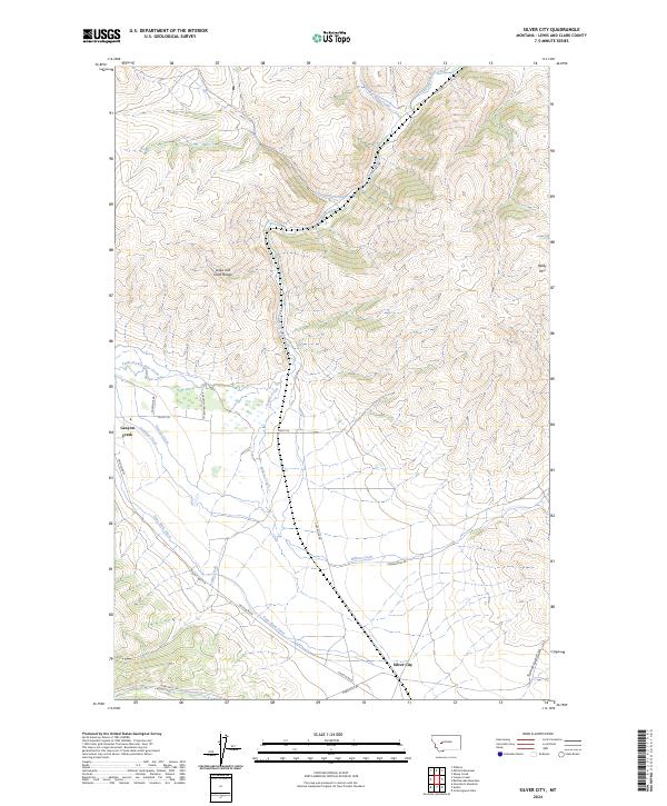
2024 Map of Silver City
USGS Topo · Published 2024About this map
Silver City and Canyon Creek anchor this study of the mountain-and-basin transition within the Lewis and Clark Range. The landscape is defined by an intricate network of irrigation and drainage, where long-established waterworks like the Gans Klein Ditch, Justisson Ditch, and Vincent Ditch divert flows across the valley floor to support local ranching and agriculture. These engineered waterways run alongside natural drainages such as Willow Creek and Trinity Creek, which descend from the high elevations of Baldy Mtn. The survey illustrates the intersection of historic transit routes and water rights, with Marysville Rd and Mount Hwy 279 cutting through the foothills. The presence of features like Trust-to-Luck Gulch hints at the region's prospecting heritage, while the extensive system of named ditches reveals the critical importance of water management in this part of Lewis and Clark County.
Find a feature on this map
26 named features on this map. Tap any name to fly to it.
Don’t see what you’re looking for? This feature index may not catch every label — zoom into the map to look around manually.
Map Details
Editions of this 2024 Silver City Map
This is the sole edition of this map. No revisions or reprints were ever made.
Other maps of this area

1889 · Helena
USGS Topo · 1:250,000

1893 · Helena
USGS Topo · 1:250,000

1899 · Helena
USGS Topo · 1:62,500

1899 · Helena
USGS Topo · 1:250,000

1903 · Helena
USGS Topo · 1:250,000

1947 · Butte
USGS Topo · 1:250,000

1950 · Helena
USGS Topo · 1:62,500

1958 · Butte
USGS Topo · 1:250,000

1959 · Elliston
USGS Topo · 1:62,500

1960 · Butte
USGS Topo · 1:250,000