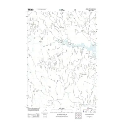
2012 Map of Silver City
USGS Topo · Published 2012About this map
Silver City sits at the heart of this topographical study, where Rapid Cr flows into the expansive Pactola Reservoir. The landscape is defined by its gold-mining heritage, evidenced by the dense network of gulches and draws such as Nugget Gulch, Gorman Gulch, and Boarding House Gulch. These features, alongside China Gulch, underscore the mineral prospecting history that shaped this section of Pennington County. High points like Scruton Mountain, home to the Bullock Lookout Tower, provide a vantage over the complex drainage systems of Slate Cr and Horse Cr.
Find a feature on this map
81 named features on this map. Tap any name to fly to it.
Don’t see what you’re looking for? This feature index may not catch every label — zoom into the map to look around manually.
Map Details
Editions of this 2012 Silver City Map
This is the sole edition of this map. No revisions or reprints were ever made.
Other maps of this area

1893 · Rapid
USGS Topo · 1:125,000

1894 · Deadwood
USGS Topo · 1:125,000

1894 · Hermosa
USGS Topo · 1:125,000

1896 · Harney Peak
USGS Topo · 1:125,000

1898 · Rapid
USGS Topo · 1:125,000

1901 · Hermosa
USGS Topo · 1:125,000

1901 · Harney Peak
USGS Topo · 1:125,000

1901 · Deadwood
USGS Topo · 1:125,000

1903 · Rapid
USGS Topo · 1:125,000

1916 · Deadwood
USGS Topo · 1:125,000