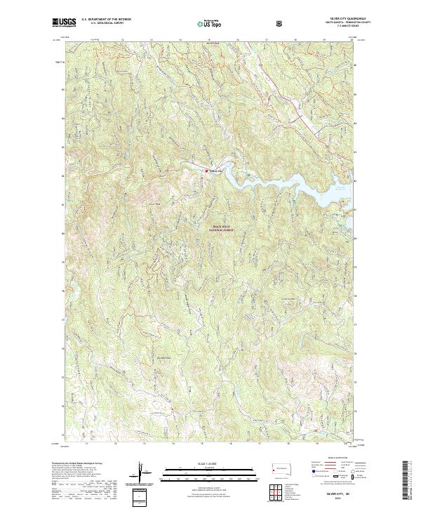
2021 Map of Silver City
USGS Topo · Published 2021About this map
Silver City remains a central point of settlement in this part of the Black Hills National Forest, where the waters of Rapid Cr flow into the Pactola Reservoir. The landscape is defined by its network of steep drainages, including the aptly named China Gulch and California Gulch, which speak to the area's prospecting and mining heritage. High points like Old Bald Peak and Scruton Mtn overlook a complex system of forest service roads and trails such as the Centennial On Mystic Trl. The map illustrates a modern era of recreation and land management, with features like the Pactola Boat Dock providing access to the reservoir, while labels such as Goose Pasture Draw and Gorman Gulch preserve the traditional place-names of the Pennington County interior.
Find a feature on this map
136 named features on this map. Tap any name to fly to it.
Don’t see what you’re looking for? This feature index may not catch every label — zoom into the map to look around manually.
Map Details
Editions of this 2021 Silver City Map
This is the sole edition of this map. No revisions or reprints were ever made.
Other maps of this area

1893 · Rapid
USGS Topo · 1:125,000

1894 · Deadwood
USGS Topo · 1:125,000

1894 · Hermosa
USGS Topo · 1:125,000

1896 · Harney Peak
USGS Topo · 1:125,000

1898 · Rapid
USGS Topo · 1:125,000

1901 · Hermosa
USGS Topo · 1:125,000

1901 · Harney Peak
USGS Topo · 1:125,000

1901 · Deadwood
USGS Topo · 1:125,000

1903 · Rapid
USGS Topo · 1:125,000

1916 · Deadwood
USGS Topo · 1:125,000