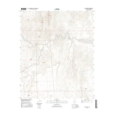
2017 Map of Silver Creek
USGS Topo · Published 2017About this map
Rio Salado carves through the central terrain of this Socorro County landscape, creating a dramatic corridor known as The Box. This arid environment is defined by a network of seasonal watercourses and topographic landmarks, including the prominent Cerro Colorado in the north and the winding Silver Creek to the south. The land is intricately partitioned by deep-cut drainages such as La Cueva Canyon and Mule Canyon, which reveal the complex geology of the high desert.
Find a feature on this map
19 named features on this map. Tap any name to fly to it.
Don’t see what you’re looking for? This feature index may not catch every label — zoom into the map to look around manually.
Map Details
Editions of this 2017 Silver Creek Map
This is the sole edition of this map. No revisions or reprints were ever made.
Other maps of this area

1906 · Socorro
USGS Topo · 1:62,500

1916 · La Joya
USGS Topo · 1:125,000

1952 · La Joya NW
USGS Topo · 1:24,000

1952 · San Anacia
USGS Topo · 1:24,000

1954 · Socorro
USGS Topo · 1:250,000

1958 · Socorro
USGS Topo · 1:250,000

1959 · Lemitar
USGS Topo · 1:24,000

1959 · Magdalena
USGS Topo · 1:62,500

1959 · Riley
USGS Topo · 1:62,500

1959 · Socorro
USGS Topo · 1:62,500