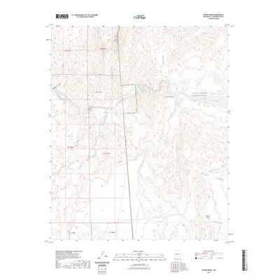
2023 Map of Silver Creek
USGS Topo · Published 2023About this map
Sevilleta National Wildlife Refuge anchors the eastern half of this terrain, where the wide course of the Rio Salado cuts through a landscape defined by deep arroyos and complex canyons. The map documents a sparsely populated region of Socorro County characterized by its drainage networks, including the southern flow of Silver Creek and the westward reach of La Jencia Creek.
Find a feature on this map
21 named features on this map. Tap any name to fly to it.
Don’t see what you’re looking for? This feature index may not catch every label — zoom into the map to look around manually.
Map Details
Editions of this 2023 Silver Creek Map
This is the sole edition of this map. No revisions or reprints were ever made.
Other maps of this area

1906 · Socorro
USGS Topo · 1:62,500

1916 · La Joya
USGS Topo · 1:125,000

1952 · La Joya NW
USGS Topo · 1:24,000

1952 · San Anacia
USGS Topo · 1:24,000

1954 · Socorro
USGS Topo · 1:250,000

1958 · Socorro
USGS Topo · 1:250,000

1959 · Lemitar
USGS Topo · 1:24,000

1959 · Magdalena
USGS Topo · 1:62,500

1959 · Riley
USGS Topo · 1:62,500

1959 · Socorro
USGS Topo · 1:62,500