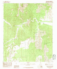
1985 Map of Silver Creek
USGS Topo · Published 1985About this map
Rio Salado carves through the central landscape of this New Mexico quadrangle, where the arid terrain is defined by deep drainages and volcanic rises. Much of the eastern portion is occupied by the Sevilleta National Wildlife Reguge, a protected expanse that borders the historic Grant Boundary. In the south, the intersection of Silver Creek and La Jencia Creek marks a confluence of intermittent watercourses below the prominent peak of Cerro Colorado. This 1985 provisional study documents a region of intricate canyon systems, including Mule Canyon and La Cueva Canyon, which highlight the erosion patterns of the Socorro County wilderness. Notable landmarks for local research include the isolated Tortola Spring and named arroyos like Arroyo Rendija, which served as vital reference points in this high-desert environment before modern development.
Find a feature on this map
15 named features on this map. Tap any name to fly to it.
Don’t see what you’re looking for? This feature index may not catch every label — zoom into the map to look around manually.
Map Details
Editions of this 1985 Silver Creek Map
This is the sole edition of this map. No revisions or reprints were ever made.
Other maps of this area

1906 · Socorro
USGS Topo · 1:62,500

1916 · La Joya
USGS Topo · 1:125,000

1952 · La Joya NW
USGS Topo · 1:24,000

1952 · San Anacia
USGS Topo · 1:24,000

1954 · Socorro
USGS Topo · 1:250,000

1958 · Socorro
USGS Topo · 1:250,000

1959 · Lemitar
USGS Topo · 1:24,000

1959 · Magdalena
USGS Topo · 1:62,500

1959 · Riley
USGS Topo · 1:62,500

1959 · Socorro
USGS Topo · 1:62,500