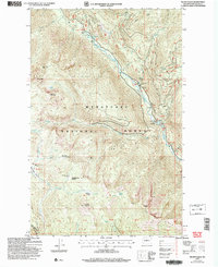
2004 Map of Silver Falls
USGS Topo · Published 2008About this map
The Entiat Mountains dominate this high-elevation landscape within the Wenatchee National Forest, where the Entiat River carves a deep valley north to south. This 2004 revision, based on earlier topographic data, illustrates the complex hydrology of the region, anchored by the dramatic Entiat Falls and Silver Falls. The presence of the Entiat River Road and numerous monitoring points like the Weather Station and Gaging Station reflect the ongoing management of these timber and water resources.
Find a feature on this map
51 named features on this map. Tap any name to fly to it.
Don’t see what you’re looking for? This feature index may not catch every label — zoom into the map to look around manually.
Map Details
Editions of this 2004 Silver Falls Map
This is the sole edition of this map. No revisions or reprints were ever made.
Other maps of this area

1899 · Methow
USGS Topo · 1:125,000

1901 · Chelan
USGS Topo · 1:125,000

1901 · Methow
USGS Topo · 1:125,000

1901 · Chiwaukum
USGS Topo · 1:125,000

1902 · Stehekin
USGS Topo · 1:125,000

1904 · Stehekin
USGS Topo · 1:125,000

1904 · Chiwaukum
USGS Topo · 1:125,000

1944 · Lucerne
USGS Topo · 1:62,500

1949 · Lucerne
USGS Topo · 1:62,500

1955 · Concrete
USGS Topo · 1:250,000