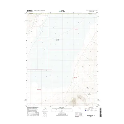
2017 Map of Silver Island Pass
USGS Topo · Published 2017About this map
Silver Island Pass serves as the focal point of this western Utah survey, carving a path through the southern reaches of the Silver Island Mountains. The map reveals a dramatic transition from the high, topographic relief of the mountains down to the flat, expansive floor of the Great Salt Lake Desert. This arid landscape is marked by the intermittent drainage of Pilot Cr, which flows toward the desert floor from the northwest. Human presence is sparse, indicated primarily by two utilitarian routes: Fenceline Rd, which tracks across the northern flats, and Campbell Rd to the east. The township and range boundaries of t3n r18w and t2n r18w provide the cadastral framework for this corner of Tooele County, where the terrain is dominated by salt flats and geological formations rather than permanent settlements.
Find a feature on this map
11 named features on this map. Tap any name to fly to it.
Don’t see what you’re looking for? This feature index may not catch every label — zoom into the map to look around manually.
Map Details
Editions of this 2017 Silver Island Pass Map
This is the sole edition of this map. No revisions or reprints were ever made.
Other maps of this area

1953 · Tooele
USGS Topo · 1:250,000

1954 · Brigham City
USGS Topo · 1:250,000

1955 · Tooele
USGS Topo · 1:250,000

1955 · Wells
USGS Topo · 1:250,000

1955 · Elko
USGS Topo · 1:250,000

1958 · Wells
USGS Topo · 1:250,000

1958 · Elko
USGS Topo · 1:250,000

1958 · Brigham City
USGS Topo · 1:250,000

1961 · Wells
USGS Topo · 1:250,000

1962 · Elko
USGS Topo · 1:250,000