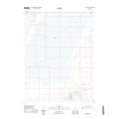
2020 Map of Silver Island Pass
USGS Topo · Published 2020About this map
Silver Island Pass serves as a critical topographic gap between the arid stretches of the Great Salt Lake Desert and the rising peaks of the Silver Island Mountains. This high-desert landscape in Tooele County is characterized by its stark drainages, most notably Pilot Cr, which cuts through the basin floor. The map highlights a remote network of unpaved tracks, including Fenceline Rd and Campbell Rd, reflecting the land's contemporary use for range management and access across the salt flats. The transition from the flat, low-elevation desert floor to the complex contours of the mountain pass reveals the stark geological isolation of this corner of the Great Basin.
Find a feature on this map
7 named features on this map. Tap any name to fly to it.
Don’t see what you’re looking for? This feature index may not catch every label — zoom into the map to look around manually.
Map Details
Editions of this 2020 Silver Island Pass Map
This is the sole edition of this map. No revisions or reprints were ever made.
Other maps of this area

1953 · Tooele
USGS Topo · 1:250,000

1954 · Brigham City
USGS Topo · 1:250,000

1955 · Tooele
USGS Topo · 1:250,000

1955 · Wells
USGS Topo · 1:250,000

1955 · Elko
USGS Topo · 1:250,000

1958 · Wells
USGS Topo · 1:250,000

1958 · Elko
USGS Topo · 1:250,000

1958 · Brigham City
USGS Topo · 1:250,000

1961 · Wells
USGS Topo · 1:250,000

1962 · Elko
USGS Topo · 1:250,000