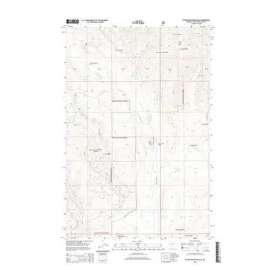
2014 Map of Silver King Mountain
USGS Topo · Published 2014About this map
The Lewis and Clark Range dominates this portion of the Helena National Forest, where the landscape is defined by the high peaks of the Alice Mountains and Silver King Mtn. This area serves as a significant drainage basin for the Landers Fork, which is fed by numerous tributaries including Indian Meadows Cr and Baking Powder Cr. The transition from high alpine terrain to lower elevations is marked by features like Indian Meadows and McDonald Meadow, providing a glimpse into the diverse montane environments of Lewis and Clark County. Human activity in this remote wilderness is evidenced by the Nelson Ranch Airport and a network of forest access roads such as Landers Fork Rd and Sucker Creek Rd. A series of small mountain basins hold Keep Cool Lakes, Snowbank Lake, and Krohn Lake, highlighting the glaciated character of these highlands.
Find a feature on this map
36 named features on this map. Tap any name to fly to it.
Don’t see what you’re looking for? This feature index may not catch every label — zoom into the map to look around manually.
Map Details
Editions of this 2014 Silver King Mountain Map
This is the sole edition of this map. No revisions or reprints were ever made.
Other maps of this area

1889 · Helena
USGS Topo · 1:250,000

1893 · Helena
USGS Topo · 1:250,000

1899 · Helena
USGS Topo · 1:250,000

1903 · Coopers Lake
USGS Topo · 1:125,000

1903 · Helena
USGS Topo · 1:250,000

1943 · Hogan
USGS Topo · 1:125,000

1947 · Butte
USGS Topo · 1:250,000

1955 · Choteau
USGS Topo · 1:250,000

1957 · Choteau
USGS Topo · 1:250,000

1958 · Butte
USGS Topo · 1:250,000