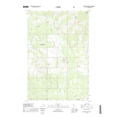
2020 Map of Silver King Mountain
USGS Topo · Published 2020About this map
Silver King Mtn and the Alice Mountains dominate this high-altitude landscape within the Helena National Forest, where a complex network of pack trails and forest roads serves the drainage basins of the Landers Fork and Copper Creek. The map reveals a high-country economy focused on recreation and ranching, evidenced by the presence of the Nelson Ranch Airport and large open areas like Indian Meadows and McDonald Meadow. Water is central to the topography here, with numerous high-mountain basins holding features such as Silver King Lake, Snowbank Lake, and the series of Keep Cool Lakes. Long-established routes like the Landers Fork Trail and Lone Mountain Trail track the ridges and valleys, illustrating the historic transit patterns through this part of Lewis and Clark County.
Find a feature on this map
40 named features on this map. Tap any name to fly to it.
Don’t see what you’re looking for? This feature index may not catch every label — zoom into the map to look around manually.
Map Details
Editions of this 2020 Silver King Mountain Map
This is the sole edition of this map. No revisions or reprints were ever made.
Other maps of this area

1889 · Helena
USGS Topo · 1:250,000

1893 · Helena
USGS Topo · 1:250,000

1899 · Helena
USGS Topo · 1:250,000

1903 · Coopers Lake
USGS Topo · 1:125,000

1903 · Helena
USGS Topo · 1:250,000

1943 · Hogan
USGS Topo · 1:125,000

1947 · Butte
USGS Topo · 1:250,000

1955 · Choteau
USGS Topo · 1:250,000

1957 · Choteau
USGS Topo · 1:250,000

1958 · Butte
USGS Topo · 1:250,000